 vesseltracker.com
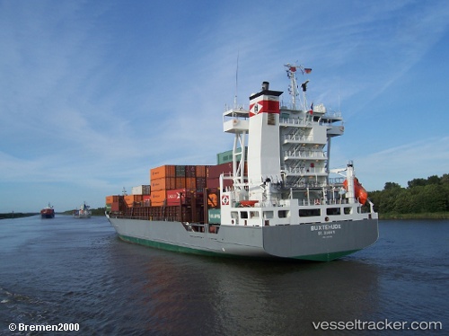
 DAGMAR
Current Status
Where is the vessel?
DAGMAR is currently in 18 nm E of Waterport, based on AIS data received about 14h ago.
Latest AIS update:
Current position: 36.08628° N, 4.98299° W (18 nm E of Waterport)
Average speed (last 7 days): Loading…
Average speed (last 30 days): Loading…
Vessel profile: DAGMAR is a Container Ship with dimensions m x m.
This page combines live AIS, route history, probable destination signals, nearby traffic, and port activity for practical vessel monitoring.
The current position of vessel DAGMAR is 36.08628 lat / -4.98299 lng. Updated: 2026-05-18 01:34:49 UTCNearest reference points:
- 30 nm E of Ceuta
- Near Waterport
- Near Sotogrande
Currently sailing under the flag of Portugal ![]()
Details:
Live Vessel DAGMAR Analytics (details, animations, etc.)
Recent AIS points (UTC):
2026-05-17 22:19:19 UTC · 36.16675, -4.39874 · SOG 3 kn · COG 164°2026-05-17 23:26:01 UTC · 36.14762, -4.39229 · SOG 13 kn · COG 268°
2026-05-18 01:30:49 UTC · 36.08830, -4.96574 · SOG 12.8 kn · COG 260°
2026-05-18 01:34:49 UTC · 36.08628, -4.98299 · SOG 12.6 kn · COG 260°