 SAFESEA LAXMI
Current Status
Where is the vessel?
SAFESEA LAXMI is currently in Near WAILINGDING ISLAND, based on AIS data received about 15h ago.
Latest AIS update:
Current position: 22.06333° N, 113.90667° E (Near WAILINGDING ISLAND)
Average speed (last 7 days): Loading…
Average speed (last 30 days): Loading…
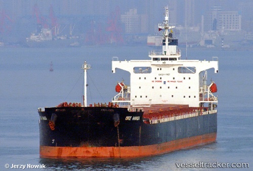
Vessel profile: SAFESEA LAXMI is a Bulk Carrier with dimensions m x m.
This page combines live AIS, route history, probable destination signals, nearby traffic, and port activity for practical vessel monitoring.
The current position of vessel SAFESEA LAXMI is 22.06333 lat / 113.90667 lng. Updated: 2026-05-18 18:11:01 UTCNearest reference points:
- Near WAILINGDING ISLAND
- Near GUISHAN
- Near Cheung Sha Wan
Currently sailing under the flag of Marshall Islands ![]()
Details:
Live Vessel SAFESEA LAXMI Analytics (details, animations, etc.)
Recent AIS points (UTC):
2026-05-18 14:16:09 UTC · 22.06360, 113.90772 · SOG 0 kn · COG -1°2026-05-18 16:13:02 UTC · 22.06398, 113.90770 · SOG 0.1 kn · COG 98°
2026-05-18 16:16:02 UTC · 22.06398, 113.90773 · SOG 0 kn · COG 92°
2026-05-18 18:11:01 UTC · 22.06333, 113.90667 · SOG 0 kn · COG -1°