 vesseltracker.com
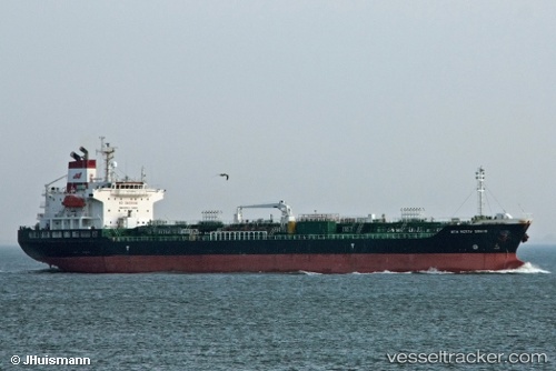
 DOLPHIN 21
Current Status
Where is the vessel?
DOLPHIN 21 is currently in Near Hoevenen, based on AIS data received about 14h ago.
Latest AIS update:
Current position: 51.27927° N, 4.35692° E (Near Hoevenen)
Average speed (last 7 days): Loading…
Average speed (last 30 days): Loading…
Vessel profile: DOLPHIN 21 is a Oil/Chemical Tanker with dimensions m x m.
This page combines live AIS, route history, probable destination signals, nearby traffic, and port activity for practical vessel monitoring.
The current position of vessel DOLPHIN 21 is 51.27927 lat / 4.35692 lng. Updated: 2026-05-18 07:38:16 UTCNearest reference points:
- Near Antwerp
- Near Kallo
- Near Kruibeke
Currently sailing under the flag of Bahamas ![]()
Details:
Live Vessel DOLPHIN 21 Analytics (details, animations, etc.)
Recent AIS points (UTC):
2026-05-18 03:41:16 UTC · 51.27923, 4.35687 · SOG 0.1 kn · COG 88°2026-05-18 04:47:16 UTC · 51.27928, 4.35687 · SOG 0.3 kn · COG 88°
2026-05-18 05:32:16 UTC · 51.27922, 4.35687 · SOG 0.1 kn · COG 88°
2026-05-18 07:38:16 UTC · 51.27927, 4.35692 · SOG 0.3 kn · COG 88°