 NICOLA L
Current Status
Where is the vessel?
NICOLA L is currently in 19 nm S of BRIGHTON MARINA, based on AIS data received about 15h ago.
Latest AIS update:
Current position: 50.50640° N, 0.20661° W (19 nm S of BRIGHTON MARINA)
Average speed (last 7 days): Loading…
Average speed (last 30 days): Loading…
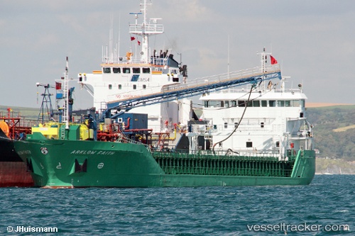
Vessel profile: NICOLA L is a General Cargo with dimensions m x m.
This page combines live AIS, route history, probable destination signals, nearby traffic, and port activity for practical vessel monitoring.
The current position of vessel NICOLA L is 50.50640 lat / -0.20661 lng. Updated: 2026-05-19 01:32:36 UTCNearest reference points:
- 23 nm S of Ferring
- 27 nm S of Seaford
- 15 nm S of Selsey
Currently sailing under the flag of Antigua and Barbuda ![]()
Details:
Live Vessel NICOLA L Analytics (details, animations, etc.)
Recent AIS points (UTC):
2026-05-18 23:00:46 UTC · 50.61057, 0.37482 · SOG 7.7 kn · COG 257°2026-05-19 00:06:27 UTC · 50.56903, 0.14373 · SOG 8.9 kn · COG 256°
2026-05-19 01:29:56 UTC · 50.50851, -0.19492 · SOG 10.4 kn · COG 253°
2026-05-19 01:32:36 UTC · 50.50640, -0.20661 · SOG 10.5 kn · COG 253°