 HAV SUND
Current Status
Where is the vessel?
HAV SUND is currently in 27 nm S of Ny Hellesund, based on AIS data received about 14h ago.
Latest AIS update:
Current position: 57.63314° N, 8.05050° E (27 nm S of Ny Hellesund)
Average speed (last 7 days): Loading…
Average speed (last 30 days): Loading…
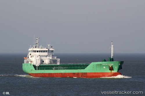
Vessel profile: HAV SUND is a General Cargo Ship with dimensions 90m x 15m.
This page combines live AIS, route history, probable destination signals, nearby traffic, and port activity for practical vessel monitoring.
The current position of vessel HAV SUND is 57.63314 lat / 8.05050 lng. Updated: 2026-05-19 00:06:22 UTCNearest reference points:
- Near Kristiansand
- Near HANSTHOLM
- 27 nm N of HANSTHOLM
Currently sailing under the flag of Faroe Islands ![]()
HAV SUND built in 2008 year
Deadweight:
4950 tDetails:
Live Vessel HAV SUND Analytics (details, animations, etc.)
Recent AIS points (UTC):
2026-05-18 20:22:31 UTC · 58.24004, 8.37760 · SOG 1.7 kn · COG 55°2026-05-18 21:44:01 UTC · 58.04186, 8.33184 · SOG 11.3 kn · COG 196°
2026-05-18 23:00:41 UTC · 57.81615, 8.18887 · SOG 10.8 kn · COG 197°
2026-05-19 00:06:22 UTC · 57.63314, 8.05050 · SOG 10.7 kn · COG 205°