Herby
Current StatusWhere is the vessel?
Herby is currently in 34 nm SW of Kiamari, based on AIS data received about 14h ago.
Latest AIS update:
Current position: 24.49300° N, 66.46533° E (34 nm SW of Kiamari)
Average speed (last 7 days): Loading…
Average speed (last 30 days): Loading…
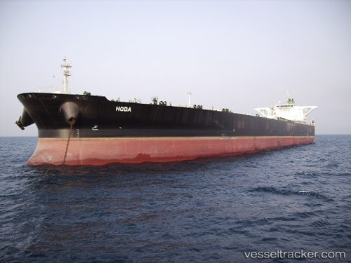
Vessel profile: Herby is a Crude Oil Tanker with dimensions 60m x 333m.
This page combines live AIS, route history, probable destination signals, nearby traffic, and port activity for practical vessel monitoring.
The current position of vessel Herby is 24.49300 lat / 66.46533 lng. Updated: 2026-05-19 01:48:34 UTCNearest reference points:
- 16 nm S of Kiamari
- Near Kiamari
- Near PORT QASIM
Details:
Live Vessel Herby Analytics (details, animations, etc.)
Recent AIS points (UTC):
2026-05-18 21:57:04 UTC · 24.49300, 66.46517 · SOG 0.1 kn · COG -1°2026-05-18 23:57:35 UTC · 24.49367, 66.46533 · SOG 0.2 kn · COG 245°
2026-05-19 01:27:35 UTC · 24.49233, 66.46550 · SOG 0.5 kn · COG 271°
2026-05-19 01:48:34 UTC · 24.49300, 66.46533 · SOG 0.5 kn · COG 244°