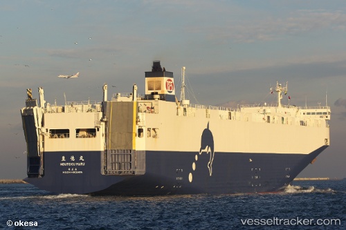
 Houtoku Maru
Current Status
Where is the vessel?
Houtoku Maru is currently in 22 nm SE of Minamisoma, based on AIS data received about 14h ago.
Latest AIS update:
Current position: 37.33642° N, 141.20255° E (22 nm SE of Minamisoma)
Average speed (last 7 days): Loading…
Average speed (last 30 days): Loading…
Vessel profile: Houtoku Maru is a Vehicles Carrier with dimensions 165m x 165m.
This page combines live AIS, route history, probable destination signals, nearby traffic, and port activity for practical vessel monitoring.
The current position of vessel Houtoku Maru is 37.33642 lat / 141.20255 lng. Updated: 2026-05-18 19:01:11 UTCNearest reference points:
- 18 nm SE of Minamisoma
- 33 nm SE of HARAMACHI
- 32 nm NE of ONAHAMA
Currently sailing under the flag of Japan ![]()
Houtoku Maru built in 2006 year
Deadweight:
5490 tDetails:
Live Vessel Houtoku Maru Analytics (details, animations, etc.)
Recent AIS points (UTC):
2026-05-18 15:34:57 UTC · 36.19527, 141.03522 · SOG 20.7 kn · COG 6°2026-05-18 16:11:15 UTC · 36.40090, 141.06680 · SOG 20.3 kn · COG 5°
2026-05-18 18:07:50 UTC · 37.05385, 141.16682 · SOG 20.1 kn · COG 5°
2026-05-18 19:01:11 UTC · 37.33642, 141.20255 · SOG 20.1 kn · COG -1°