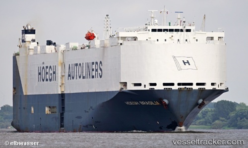
 VIKING BRASILIA
Current Status
Where is the vessel?
VIKING BRASILIA is currently in 25 nm NW of Santa Cantalina, based on AIS data received about 14h ago.
Latest AIS update:
Current position: 10.95553° N, 75.49359° W (25 nm NW of Santa Cantalina)
Average speed (last 7 days): Loading…
Average speed (last 30 days): Loading…
Vessel profile: VIKING BRASILIA is a Vehicles Carrier with dimensions m x m.
This page combines live AIS, route history, probable destination signals, nearby traffic, and port activity for practical vessel monitoring.
The current position of vessel VIKING BRASILIA is 10.95553 lat / -75.49359 lng. Updated: 2026-05-20 14:01:38 UTCNearest reference points:
- Near Sociedad Portuaria Regional Cartagena
- Near Contecar
- Near Santa Marta
Currently sailing under the flag of Marshall Islands ![]()
Details:
Live Vessel VIKING BRASILIA Analytics (details, animations, etc.)
Recent AIS points (UTC):
2026-05-20 10:22:05 UTC · 11.38997, -74.84967 · SOG 12 kn · COG 246°2026-05-20 12:20:34 UTC · 11.17418, -75.20525 · SOG 12.9 kn · COG 232°
2026-05-20 13:31:29 UTC · 11.02154, -75.40989 · SOG 12.3 kn · COG 230°
2026-05-20 14:01:38 UTC · 10.95553, -75.49359 · SOG 12.4 kn · COG 223°