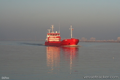
 Emma
Emma
Current Status
Where is the vessel?
Emma is currently in 33 nm NW of Eckerö, based on AIS data received about 14h ago.
Latest AIS update:
Current position: 60.68971° N, 19.08137° E (33 nm NW of Eckerö)
Average speed (last 7 days): Loading…
Average speed (last 30 days): Loading…
Vessel profile: Emma is a General Cargo Ship with dimensions 90m x 13m.
This page combines live AIS, route history, probable destination signals, nearby traffic, and port activity for practical vessel monitoring.
The current position of vessel Emma is 60.68971 lat / 19.08137 lng. Updated: 2026-05-20 01:06:30 UTCNearest reference points:
- Near Östhammar
- Near Hallstavik
- Near GRADDO
Currently sailing under the flag of Netherlands ![]()
Emma built in 2007 year
Deadweight:
3500 tDetails:
Live Vessel Emma Analytics (details, animations, etc.)
Recent AIS points (UTC):
2026-05-19 21:40:40 UTC · 61.18883, 19.30560 · SOG 9 kn · COG 190°2026-05-19 22:48:30 UTC · 61.02328, 19.23012 · SOG 9 kn · COG 189°
2026-05-20 00:01:24 UTC · 60.84744, 19.14843 · SOG 8.8 kn · COG 188°
2026-05-20 01:06:30 UTC · 60.68971, 19.08137 · SOG 9 kn · COG 190°