 vesseltracker.com
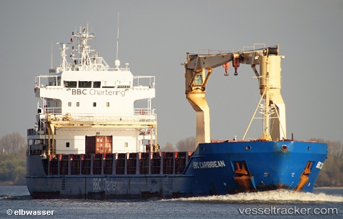
 KIMBERLY
Current Status
Where is the vessel?
KIMBERLY is currently in 15 nm NW of Pilies juru uosto PVP/Klaipeda, based on AIS data received about 15h ago.
Latest AIS update:
Current position: 55.81572° N, 20.67707° E (15 nm NW of Pilies juru uosto PVP/Klaipeda)
Average speed (last 7 days): Loading…
Average speed (last 30 days): Loading…
Vessel profile: KIMBERLY is a Multi Purpose Carrier with dimensions 116m x 16m.
This page combines live AIS, route history, probable destination signals, nearby traffic, and port activity for practical vessel monitoring.
The current position of vessel KIMBERLY is 55.81572 lat / 20.67707 lng. Updated: 2026-05-18 05:55:24 UTCNearest reference points:
- Near Klaipeda
- 39 nm W of Pilies juru uosto PVP/Klaipeda
- Near Cimdenieki
Currently sailing under the flag of Antigua Barbuda ![]()
KIMBERLY built in 0 year
Deadweight:
0 tDetails:
ex Bbc Caribbean
ex MMSI: 305238000
Live Vessel KIMBERLY Analytics (details, animations, etc.)
Recent AIS points (UTC):
2026-05-18 02:18:33 UTC · 56.39629, 20.59855 · SOG 9.9 kn · COG 180°2026-05-18 03:56:14 UTC · 56.12969, 20.61431 · SOG 9.9 kn · COG 171°
2026-05-18 04:14:03 UTC · 56.08099, 20.62400 · SOG 9.8 kn · COG 171°
2026-05-18 05:55:24 UTC · 55.81572, 20.67707 · SOG 8.5 kn · COG 171°