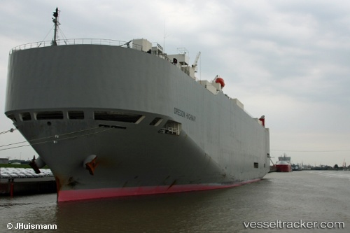
Oregon Highway
Current StatusWhere is the vessel?
Oregon Highway is currently in 336 nm S of CLARK'S HARBOUR, based on AIS data received about 14h ago.
Latest AIS update:
Current position: 38.02352° N, 63.76673° W (336 nm S of CLARK'S HARBOUR)
Average speed (last 7 days): Loading…
Average speed (last 30 days): Loading…
Vessel profile: Oregon Highway is a Vehicles Carrier with dimensions 32m x 199m.
This page combines live AIS, route history, probable destination signals, nearby traffic, and port activity for practical vessel monitoring.
The current position of vessel Oregon Highway is 38.02352 lat / -63.76673 lng. Updated: 2026-05-19 04:09:06 UTCDetails:
Live Vessel Oregon Highway Analytics (details, animations, etc.)
Recent AIS points (UTC):
2026-05-19 01:08:38 UTC · 38.17954, -62.96443 · SOG 14.3 kn · COG 253°2026-05-19 01:25:57 UTC · 38.16333, -63.04880 · SOG 14.2 kn · COG 251°
2026-05-19 03:56:55 UTC · 38.03566, -63.71981 · SOG 11.7 kn · COG 247°
2026-05-19 04:09:06 UTC · 38.02352, -63.76673 · SOG 11.5 kn · COG 243°