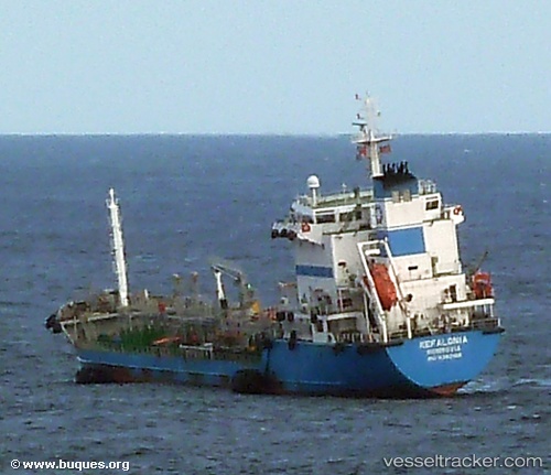
 KEFALONIA
Current Status
Where is the vessel?
KEFALONIA is currently in Near TANGER MED, based on AIS data received about 15h ago.
Latest AIS update:
Current position: 35.95456° N, 5.47252° W (Near TANGER MED)
Average speed (last 7 days): Loading…
Average speed (last 30 days): Loading…
Vessel profile: KEFALONIA is a Oil Products Tanker with dimensions m x m.
This page combines live AIS, route history, probable destination signals, nearby traffic, and port activity for practical vessel monitoring.
The current position of vessel KEFALONIA is 35.95456 lat / -5.47252 lng. Updated: 2026-05-22 04:27:15 UTCNearest reference points:
- Near TANGER MED
- Near Algeciras
- Near TARIFA
Currently sailing under the flag of Cyprus ![]()
Details:
Live Vessel KEFALONIA Analytics (details, animations, etc.)
Recent AIS points (UTC):
2026-05-22 01:22:33 UTC · 35.89405, -5.50144 · SOG 0 kn · COG 36°2026-05-22 02:34:29 UTC · 35.89405, -5.50141 · SOG 0 kn · COG 36°
2026-05-22 04:00:45 UTC · 35.89615, -5.49798 · SOG 4.4 kn · COG 52°
2026-05-22 04:27:15 UTC · 35.95456, -5.47252 · SOG 9.8 kn · COG 25°