 vesseltracker.com
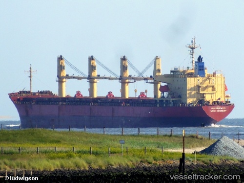
 AMIRA LOULIA
Current Status
Where is the vessel?
AMIRA LOULIA is currently in Near Algiers, based on AIS data received about 14h ago.
Latest AIS update:
Current position: 36.80031° N, 3.09281° E (Near Algiers)
Average speed (last 7 days): Loading…
Average speed (last 30 days): Loading…
Vessel profile: AMIRA LOULIA is a General Cargo with dimensions m x m.
This page combines live AIS, route history, probable destination signals, nearby traffic, and port activity for practical vessel monitoring.
The current position of vessel AMIRA LOULIA is 36.80031 lat / 3.09281 lng. Updated: 2026-05-18 07:50:11 UTCNearest reference points:
- Near Algiers
- 16 nm NE of Berja
- 17 nm S of Albanchez
Currently sailing under the flag of San Marino ![]()
Details:
Live Vessel AMIRA LOULIA Analytics (details, animations, etc.)
Recent AIS points (UTC):
2026-05-18 04:47:01 UTC · 36.80092, 3.09239 · SOG 0 kn · COG 88°2026-05-18 05:31:54 UTC · 36.79991, 3.09325 · SOG 0 kn · COG 35°
2026-05-18 07:41:03 UTC · 36.80029, 3.09274 · SOG 0 kn · COG 59°
2026-05-18 07:50:11 UTC · 36.80031, 3.09281 · SOG 0 kn · COG 61°