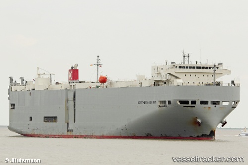
Northern Highway
Current StatusWhere is the vessel?
Northern Highway is currently in 39 nm NW of Dai Hung (STS Load), based on AIS data received about 18h ago.
Latest AIS update:
Current position: 9.25483° N, 102.77908° E (39 nm NW of Dai Hung (STS Load))
Average speed (last 7 days): Loading…
Average speed (last 30 days): Loading…
Vessel profile: Northern Highway is a Vehicles Carrier with dimensions 28m x 188m.
This page combines live AIS, route history, probable destination signals, nearby traffic, and port activity for practical vessel monitoring.
The current position of vessel Northern Highway is 9.25483 lat / 102.77908 lng. Updated: 2026-05-20 09:35:40 UTCNearest reference points:
- 46 nm W of Dai Hung (STS Load)
- 63 nm NW of Dai Hung (STS Load)
- 30 nm E of Dai Hung (STS Load)
Details:
Live Vessel Northern Highway Analytics (details, animations, etc.)
Recent AIS points (UTC):
2026-05-20 09:35:40 UTC · 9.25483, 102.77908 · SOG 16.2 kn · COG -1°2026-05-20 09:35:40 UTC · 9.25483, 102.77908 · SOG 16.2 kn · COG -1°
2026-05-20 09:35:40 UTC · 9.25483, 102.77908 · SOG 16.2 kn · COG -1°
2026-05-20 09:35:40 UTC · 9.25483, 102.77908 · SOG 16.2 kn · COG -1°