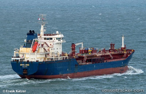
 ARSLAND
Current Status
Where is the vessel?
ARSLAND is currently in Near Antalya Free Zone, based on AIS data received about 15h ago.
Latest AIS update:
Current position: 36.80333° N, 30.59390° E (Near Antalya Free Zone)
Average speed (last 7 days): Loading…
Average speed (last 30 days): Loading…
Vessel profile: ARSLAND is a Oil/Chemical Tanker with dimensions m x m.
This page combines live AIS, route history, probable destination signals, nearby traffic, and port activity for practical vessel monitoring.
The current position of vessel ARSLAND is 36.80333 lat / 30.59390 lng. Updated: 2026-05-19 08:18:47 UTCNearest reference points:
- Near Antalya Free Zone
- Near Antalya
- Near Kemer
Currently sailing under the flag of Turkey ![]()
Details:
Live Vessel ARSLAND Analytics (details, animations, etc.)
Recent AIS points (UTC):
2026-05-19 04:29:51 UTC · 36.76831, 30.69121 · SOG 7.9 kn · COG 306°2026-05-19 05:49:41 UTC · 36.80335, 30.59404 · SOG 0.2 kn · COG 131°
2026-05-19 07:02:22 UTC · 36.80331, 30.59384 · SOG 0 kn · COG 128°
2026-05-19 08:18:47 UTC · 36.80333, 30.59390 · SOG 0 kn · COG 128°