 HARBIYE
Current Status
Where is the vessel?
HARBIYE is currently in 79 nm NW of Jarjis, based on AIS data received about 15h ago.
Latest AIS update:
Current position: 34.00731° N, 12.56665° W (79 nm NW of Jarjis)
Average speed (last 7 days): Loading…
Average speed (last 30 days): Loading…
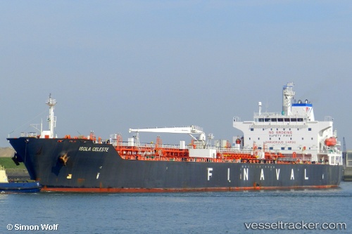
Vessel profile: HARBIYE is a Oil/Chemical Tanker with dimensions m x m.
This page combines live AIS, route history, probable destination signals, nearby traffic, and port activity for practical vessel monitoring.
The current position of vessel HARBIYE is 34.00731 lat / -12.56665 lng. Updated: 2026-05-18 17:32:46 UTCNearest reference points:
- 104 nm W of Jarjis
- 25 nm SW of Jarjis
- 101 nm SW of Jarjis
Currently sailing under the flag of Panama ![]()
Details:
Live Vessel HARBIYE Analytics (details, animations, etc.)
Recent AIS points (UTC):
2026-05-18 13:42:17 UTC · 34.08647, -12.58148 · SOG 1.1 kn · COG 83°2026-05-18 15:23:26 UTC · 34.05214, -12.57301 · SOG 1.2 kn · COG 98°
2026-05-18 15:23:26 UTC · 34.05214, -12.57301 · SOG 1.2 kn · COG 98°
2026-05-18 17:32:46 UTC · 34.00731, -12.56665 · SOG 1.4 kn · COG 95°