 vesseltracker.com
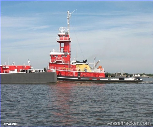
Linda Lee Bouchard
Current StatusWhere is the vessel?
Linda Lee Bouchard is currently in 21 nm SW of Tatoosh Island, based on AIS data received about 14h ago.
Latest AIS update:
Current position: 48.13046° N, 125.10740° W (21 nm SW of Tatoosh Island)
Average speed (last 7 days): Loading…
Average speed (last 30 days): Loading…
Vessel profile: Linda Lee Bouchard is a Pusher Tug with dimensions 24m x 162m.
This page combines live AIS, route history, probable destination signals, nearby traffic, and port activity for practical vessel monitoring.
The current position of vessel Linda Lee Bouchard is 48.13046 lat / -125.10740 lng. Updated: 2026-05-17 19:52:56 UTCNearest reference points:
- 21 nm NW of Tatoosh Island
- Near Clallam Bay
- Near Colwood
Details:
Live Vessel Linda Lee Bouchard Analytics (details, animations, etc.)
Recent AIS points (UTC):
2026-05-17 15:29:11 UTC · 48.45060, -124.71227 · SOG 6.8 kn · COG 305°2026-05-17 17:01:51 UTC · 48.40924, -124.94459 · SOG 6.4 kn · COG 200°
2026-05-17 17:53:20 UTC · 48.32317, -124.99718 · SOG 6.3 kn · COG 198°
2026-05-17 19:52:56 UTC · 48.13046, -125.10740 · SOG 5.9 kn · COG 210°