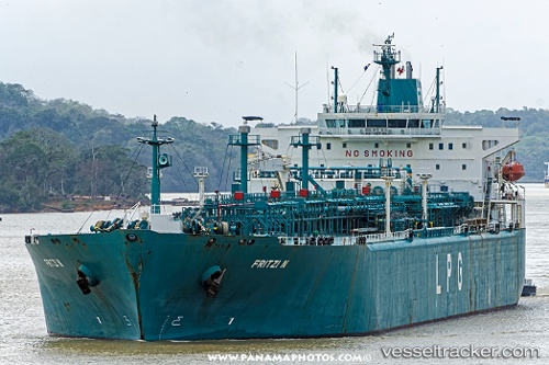
 FRITZI N
Current Status
Where is the vessel?
FRITZI N is currently in 281 nm W of Juazeiro-Pi, based on AIS data received about 14h ago.
Latest AIS update:
Current position: 5.46228° N, 46.36635° W (281 nm W of Juazeiro-Pi)
Average speed (last 7 days): Loading…
Average speed (last 30 days): Loading…
Vessel profile: FRITZI N is a Lpg Tanker with dimensions m x m.
This page combines live AIS, route history, probable destination signals, nearby traffic, and port activity for practical vessel monitoring.
The current position of vessel FRITZI N is 5.46228 lat / -46.36635 lng. Updated: 2026-05-19 17:47:02 UTCNearest reference points:
- 227 nm W of Juazeiro-Pi
- 303 nm NE of Cayenne
Currently sailing under the flag of Marshall Islands ![]()
Details:
Live Vessel FRITZI N Analytics (details, animations, etc.)
Recent AIS points (UTC):
2026-05-19 14:02:52 UTC · 5.93021, -47.04158 · SOG 13.1 kn · COG 124°2026-05-19 15:37:33 UTC · 5.73114, -46.75810 · SOG 13.1 kn · COG 123°
2026-05-19 16:59:13 UTC · 5.56201, -46.51287 · SOG 13.1 kn · COG 122°
2026-05-19 17:47:02 UTC · 5.46228, -46.36635 · SOG 13.3 kn · COG 121°