 vesseltracker.com
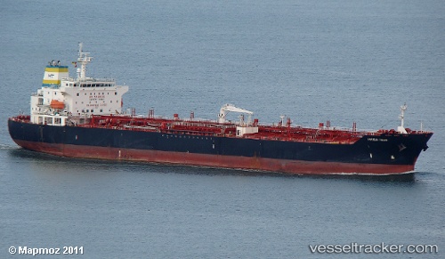
 HORIZON THEONI
Current Status
Where is the vessel?
HORIZON THEONI is currently in Near Barra Grande, based on AIS data received about 14h ago.
Latest AIS update:
Current position: 13.04164° S, 38.62346° W (Near Barra Grande)
Average speed (last 7 days): Loading…
Average speed (last 30 days): Loading…
Vessel profile: HORIZON THEONI is a Oil/Chemical Tanker with dimensions m x m.
This page combines live AIS, route history, probable destination signals, nearby traffic, and port activity for practical vessel monitoring.
The current position of vessel HORIZON THEONI is -13.04164 lat / -38.62346 lng. Updated: 2026-05-18 04:56:44 UTCNearest reference points:
- Near Aracaju
- Near Barra dos Coqueiros
Currently sailing under the flag of Malta ![]()
Details:
Live Vessel HORIZON THEONI Analytics (details, animations, etc.)
Recent AIS points (UTC):
2026-05-18 00:59:44 UTC · -13.04279, -38.62548 · SOG 0.1 kn · COG 104°2026-05-18 01:56:47 UTC · -13.04192, -38.62483 · SOG 0 kn · COG 148°
2026-05-18 03:35:48 UTC · -13.04165, -38.62376 · SOG 0.1 kn · COG 169°
2026-05-18 04:56:44 UTC · -13.04164, -38.62346 · SOG 0 kn · COG 175°