 vesseltracker.com
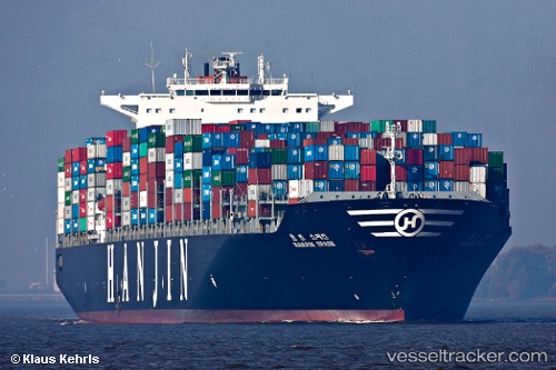
Navios Constellation
Current StatusWhere is the vessel?
Navios Constellation is currently in Near BUSAN NEW PORT, based on AIS data received about 14h ago.
Latest AIS update:
Current position: 35.01024° N, 128.79272° E (Near BUSAN NEW PORT)
Average speed (last 7 days): Loading…
Average speed (last 30 days): Loading…
Vessel profile: Navios Constellation is a Container Ship with dimensions 46m x 350m.
This page combines live AIS, route history, probable destination signals, nearby traffic, and port activity for practical vessel monitoring.
The current position of vessel Navios Constellation is 35.01024 lat / 128.79272 lng. Updated: 2026-05-18 14:12:21 UTCNearest reference points:
- Near BUSAN NEW PORT
- Near OKPO
- Near Jinhae
Details:
Live Vessel Navios Constellation Analytics (details, animations, etc.)
Recent AIS points (UTC):
2026-05-18 10:52:12 UTC · 35.07746, 128.81207 · SOG 0 kn · COG 90°2026-05-18 11:49:27 UTC · 35.07731, 128.81216 · SOG 0 kn · COG 90°
2026-05-18 13:43:10 UTC · 35.07181, 128.79482 · SOG 5.1 kn · COG 248°
2026-05-18 14:12:21 UTC · 35.01024, 128.79272 · SOG 9 kn · COG 165°