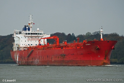
 STAR C
Current Status
Where is the vessel?
STAR C is currently in Near Lillo, based on AIS data received about 14h ago.
Latest AIS update:
Current position: 51.28956° N, 4.33811° E (Near Lillo)
Average speed (last 7 days): Loading…
Average speed (last 30 days): Loading…
Vessel profile: STAR C is a Chemical Oil Products Tanker with dimensions 184m x 27m.
This page combines live AIS, route history, probable destination signals, nearby traffic, and port activity for practical vessel monitoring.
The current position of vessel STAR C is 51.28956 lat / 4.33811 lng. Updated: 2026-05-20 10:23:56 UTCNearest reference points:
- Near Antwerp
- Near Kallo
- Near Doel
Currently sailing under the flag of Liberia ![]()
STAR C built in 2009 year
Deadweight:
37836 tDetails:
Live Vessel STAR C Analytics (details, animations, etc.)
Recent AIS points (UTC):
2026-05-20 07:41:55 UTC · 51.28952, 4.33817 · SOG 0 kn · COG 152°2026-05-20 08:05:53 UTC · 51.28956, 4.33811 · SOG 0 kn · COG 152°
2026-05-20 09:38:56 UTC · 51.28956, 4.33810 · SOG 0 kn · COG 152°
2026-05-20 10:23:56 UTC · 51.28956, 4.33811 · SOG 0 kn · COG 152°