 Cala Paguro
Current Status
Where is the vessel?
Cala Paguro is currently in 112 nm SW of Yetagun Field, based on AIS data received about 1d ago.
Latest AIS update:
Current position: 11.86730° N, 95.36685° E (112 nm SW of Yetagun Field)
Average speed (last 7 days): Loading…
Average speed (last 30 days): Loading…
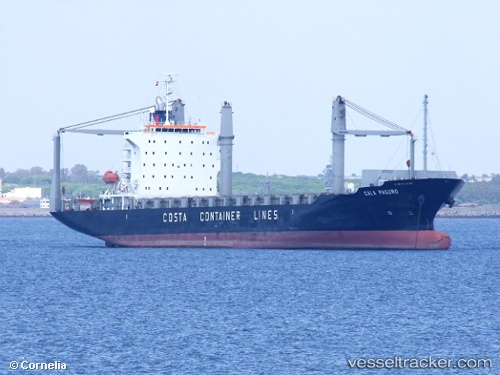
Vessel profile: Cala Paguro is a Container Ship with dimensions 172m x 28m.
This page combines live AIS, route history, probable destination signals, nearby traffic, and port activity for practical vessel monitoring.
The current position of vessel Cala Paguro is 11.86730 lat / 95.36685 lng. Updated: 2026-06-04 01:19:00 UTCNearest reference points:
- 126 nm S of Yetagun Field
- 175 nm W of Ranong Apt
- 84 nm NW of Yetagun Field
Currently sailing under the flag of Liberia ![]()
Cala Paguro built in 2007 year
Deadweight:
21442 tDetails:
Live Vessel Cala Paguro Analytics (details, animations, etc.)
Recent AIS points (UTC):
2026-06-04 01:19:00 UTC · 11.86730, 95.36685 · SOG 15.6 kn · COG -1°2026-06-04 01:19:00 UTC · 11.86730, 95.36685 · SOG 15.6 kn · COG -1°
2026-06-04 01:19:00 UTC · 11.86730, 95.36685 · SOG 15.6 kn · COG -1°
2026-06-04 01:19:00 UTC · 11.86730, 95.36685 · SOG 15.6 kn · COG -1°