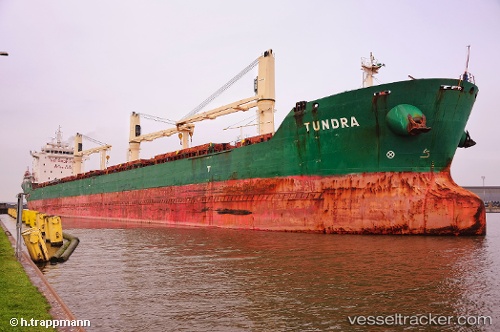
Tundra
Current StatusWhere is the vessel?
Tundra is currently in 115 nm SW of White Rose Field, based on AIS data received about 14h ago.
Latest AIS update:
Current position: 45.99667° N, 50.53167° W (115 nm SW of White Rose Field)
Average speed (last 7 days): Loading…
Average speed (last 30 days): Loading…
Vessel profile: Tundra is a Bulk Carrier with dimensions 23m x 185m.
This page combines live AIS, route history, probable destination signals, nearby traffic, and port activity for practical vessel monitoring.
The current position of vessel Tundra is 45.99667 lat / -50.53167 lng. Updated: 2026-05-20 01:39:38 UTCNearest reference points:
- 24 nm SW of White Rose Field
- Near Witless Bay
- Near St. John’S
Details:
Live Vessel Tundra Analytics (details, animations, etc.)
Recent AIS points (UTC):
2026-05-19 22:15:42 UTC · 45.99667, -51.49333 · SOG 11 kn · COG -1°2026-05-19 23:25:22 UTC · 45.99723, -51.16917 · SOG 11.7 kn · COG 86°
2026-05-20 01:36:38 UTC · 45.99667, -50.54667 · SOG 11 kn · COG -1°
2026-05-20 01:39:38 UTC · 45.99667, -50.53167 · SOG 12 kn · COG -1°