 Dong A Metis
Current Status
Where is the vessel?
Dong A Metis is currently in 37 nm SE of Marsh Harbour, based on AIS data received about 14h ago.
Latest AIS update:
Current position: 26.19040° N, 76.40165° W (37 nm SE of Marsh Harbour)
Average speed (last 7 days): Loading…
Average speed (last 30 days): Loading…
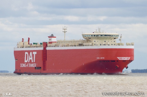
Vessel profile: Dong A Metis is a Vehicles Carrier with dimensions 199m x 32m.
This page combines live AIS, route history, probable destination signals, nearby traffic, and port activity for practical vessel monitoring.
The current position of vessel Dong A Metis is 26.19040 lat / -76.40165 lng. Updated: 2026-05-19 23:40:23 UTCNearest reference points:
- 22 nm E of Harbour Island
- Near Harbour Island
- 31 nm E of Harbour Island
Currently sailing under the flag of Panama ![]()
Dong A Metis built in 2010 year
Deadweight:
22582 tDetails:
Live Vessel Dong A Metis Analytics (details, animations, etc.)
Recent AIS points (UTC):
2026-05-19 20:25:30 UTC · 26.81686, -76.86694 · SOG 13.5 kn · COG 138°2026-05-19 22:07:46 UTC · 26.48994, -76.62441 · SOG 13.8 kn · COG 146°
2026-05-19 23:03:24 UTC · 26.30839, -76.49138 · SOG 14.2 kn · COG 143°
2026-05-19 23:40:23 UTC · 26.19040, -76.40165 · SOG 13.6 kn · COG 143°