 vesseltracker.com
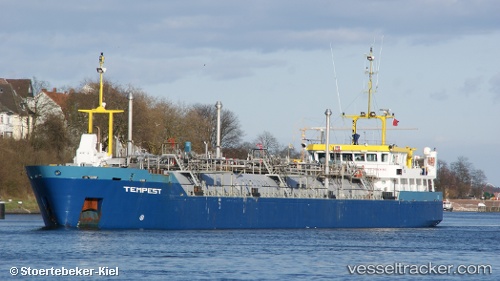
 Tempest
Current Status
Where is the vessel?
Tempest is currently in 12 nm W of Hijum, based on AIS data received about 14h ago.
Latest AIS update:
Current position: 53.23513° N, 4.44241° E (12 nm W of Hijum)
Average speed (last 7 days): Loading…
Average speed (last 30 days): Loading…
Vessel profile: Tempest is a Lpg Tanker with dimensions 100m x 100m.
This page combines live AIS, route history, probable destination signals, nearby traffic, and port activity for practical vessel monitoring.
The current position of vessel Tempest is 53.23513 lat / 4.44241 lng. Updated: 2026-05-17 23:15:49 UTCNearest reference points:
- Near Molengat
- Near de Waal
- Near Den Helder
Currently sailing under the flag of Netherlands ![]()
Tempest built in 2008 year
Deadweight:
1809 tDetails:
Live Vessel Tempest Analytics (details, animations, etc.)
Recent AIS points (UTC):
2026-05-17 19:45:59 UTC · 53.77667, 4.77667 · SOG 9 kn · COG -1°2026-05-17 20:24:58 UTC · 53.68833, 4.70167 · SOG 9 kn · COG -1°
2026-05-17 22:40:41 UTC · 53.33428, 4.49923 · SOG 10.5 kn · COG 196°
2026-05-17 23:15:49 UTC · 53.23513, 4.44241 · SOG 11 kn · COG 195°