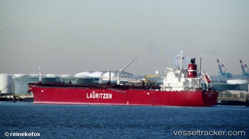
 ULYSSES I
Current Status
Where is the vessel?
ULYSSES I is currently in 14 nm S of Gibraltar, based on AIS data received about 14h ago.
Latest AIS update:
Current position: 35.90144° N, 6.32494° W (14 nm S of Gibraltar)
Average speed (last 7 days): Loading…
Average speed (last 30 days): Loading…
Vessel profile: ULYSSES I is a Oil Products Tanker with dimensions m x m.
This page combines live AIS, route history, probable destination signals, nearby traffic, and port activity for practical vessel monitoring.
The current position of vessel ULYSSES I is 35.90144 lat / -6.32494 lng. Updated: 2026-05-19 12:26:17 UTCNearest reference points:
- Near Gibraltar
- Near Conil de la Frontera
- Near Cadiz
Currently sailing under the flag of Liberia ![]()
Details:
Live Vessel ULYSSES I Analytics (details, animations, etc.)
Recent AIS points (UTC):
2026-05-19 07:52:58 UTC · 36.12687, -7.47276 · SOG 13 kn · COG 104°2026-05-19 10:12:28 UTC · 36.00588, -6.88148 · SOG 10.9 kn · COG 110°
2026-05-19 10:54:37 UTC · 35.97201, -6.72492 · SOG 12.1 kn · COG 102°
2026-05-19 12:26:17 UTC · 35.90144, -6.32494 · SOG 13.2 kn · COG 103°