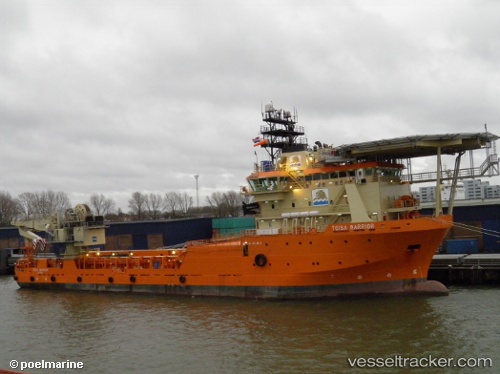
Ile Douessant
Current StatusWhere is the vessel?
Ile Douessant is currently in Near Land's End, based on AIS data received about 16h ago.
Latest AIS update:
Current position: 50.08788° N, 5.72382° W (Near Land's End)
Average speed (last 7 days): Loading…
Average speed (last 30 days): Loading…
Vessel profile: Ile Douessant is a Offshore Tug Supply Ship with dimensions 19m x 87m.
This page combines live AIS, route history, probable destination signals, nearby traffic, and port activity for practical vessel monitoring.
The current position of vessel Ile Douessant is 50.08788 lat / -5.72382 lng. Updated: 2026-05-19 07:52:05 UTCNearest reference points:
- 10 nm NW of Grampound
- 28 nm S of Porthgwarra
- Near Isles of Scilly
Details:
Live Vessel Ile Douessant Analytics (details, animations, etc.)
Recent AIS points (UTC):
2026-05-19 04:58:26 UTC · 50.08776, -5.72376 · SOG 0.7 kn · COG 226°2026-05-19 05:46:26 UTC · 50.08778, -5.72368 · SOG 0.3 kn · COG 220°
2026-05-19 07:34:36 UTC · 50.08785, -5.72379 · SOG 0.1 kn · COG 241°
2026-05-19 07:52:05 UTC · 50.08788, -5.72382 · SOG 0.2 kn · COG 251°