 vesseltracker.com
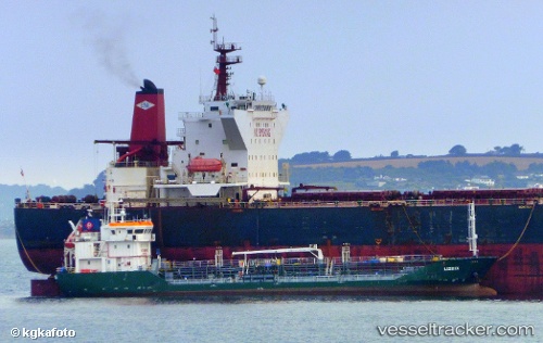
 ANDREA
Current Status
Where is the vessel?
ANDREA is currently in Near Vigrestad, based on AIS data received about 14h ago.
Latest AIS update:
Current position: 58.52862° N, 5.61430° E (Near Vigrestad)
Average speed (last 7 days): Loading…
Average speed (last 30 days): Loading…
Vessel profile: ANDREA is a Oil Products Tanker with dimensions 77m x 11m.
This page combines live AIS, route history, probable destination signals, nearby traffic, and port activity for practical vessel monitoring.
The current position of vessel ANDREA is 58.52862 lat / 5.61430 lng. Updated: 2026-05-18 13:37:49 UTCNearest reference points:
- Near Lura
- Near Egersund
- Near Åna-Sira
Currently sailing under the flag of Denmark ![]()
ANDREA built in 2008 year
Deadweight:
1942 tDetails:
Live Vessel ANDREA Analytics (details, animations, etc.)
Recent AIS points (UTC):
2026-05-18 09:49:16 UTC · 58.13619, 6.42203 · SOG 9.7 kn · COG 312°2026-05-18 10:46:26 UTC · 58.23619, 6.21002 · SOG 9 kn · COG 310°
2026-05-18 11:54:56 UTC · 58.35069, 5.96807 · SOG 8.6 kn · COG 310°
2026-05-18 13:37:49 UTC · 58.52862, 5.61430 · SOG 9.4 kn · COG 335°