 vesseltracker.com
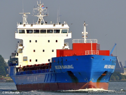
 WILSON NANJING
Current Status
Where is the vessel?
WILSON NANJING is currently in Near Hunsdon, based on AIS data received about 14h ago.
Latest AIS update:
Current position: 51.82695° N, 3.40757° E (Near Hunsdon)
Average speed (last 7 days): Loading…
Average speed (last 30 days): Loading…
Vessel profile: WILSON NANJING is a General Cargo with dimensions m x m.
This page combines live AIS, route history, probable destination signals, nearby traffic, and port activity for practical vessel monitoring.
The current position of vessel WILSON NANJING is 51.82695 lat / 3.40757 lng. Updated: 2026-05-18 03:42:03 UTCNearest reference points:
- 12 nm NE of Hunsdon
- Near Hunsdon
- Near NEELTJE JANS
Currently sailing under the flag of Bahamas ![]()
Details:
Live Vessel WILSON NANJING Analytics (details, animations, etc.)
Recent AIS points (UTC):
2026-05-17 23:24:12 UTC · 51.82392, 3.40638 · SOG 0 kn · COG 60°2026-05-18 01:48:06 UTC · 51.82593, 3.40895 · SOG 0 kn · COG 218°
2026-05-18 02:12:03 UTC · 51.82635, 3.40875 · SOG 0.3 kn · COG 218°
2026-05-18 03:42:03 UTC · 51.82695, 3.40757 · SOG 0 kn · COG 230°