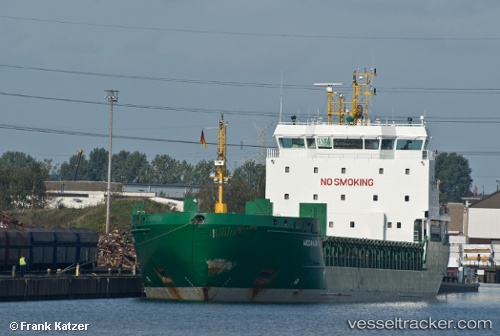
 Halland
Current Status
Where is the vessel?
Halland is currently in 43 nm NW of Pavilosta, based on AIS data received about 15h ago.
Latest AIS update:
Current position: 57.21252° N, 20.01831° E (43 nm NW of Pavilosta)
Average speed (last 7 days): Loading…
Average speed (last 30 days): Loading…
Vessel profile: Halland is a Multi Purpose Carrier with dimensions 119m x 16m.
This page combines live AIS, route history, probable destination signals, nearby traffic, and port activity for practical vessel monitoring.
The current position of vessel Halland is 57.21252 lat / 20.01831 lng. Updated: 2026-05-22 02:44:34 UTCNearest reference points:
- Near Cimdenieki
- Near Ventspils
- 37 nm W of Vikati Sadam
Currently sailing under the flag of Cyprus ![]()
Halland built in 2008 year
Deadweight:
6795 tDetails:
Live Vessel Halland Analytics (details, animations, etc.)
Recent AIS points (UTC):
2026-05-21 22:09:14 UTC · 56.83499, 18.63590 · SOG 10.9 kn · COG 63°2026-05-22 01:22:13 UTC · 57.10025, 19.61118 · SOG 11.2 kn · COG 62°
2026-05-22 01:32:34 UTC · 57.11489, 19.66366 · SOG 11 kn · COG 62°
2026-05-22 02:44:34 UTC · 57.21252, 20.01831 · SOG 10.8 kn · COG 62°