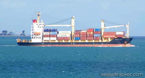
Gazelle Coast
Current StatusWhere is the vessel?
Gazelle Coast is currently in 60 nm N of Lae, based on AIS data received about 14h ago.
Latest AIS update:
Current position: 5.75835° S, 147.15289° E (60 nm N of Lae)
Average speed (last 7 days): Loading…
Average speed (last 30 days): Loading…
Vessel profile: Gazelle Coast is a Container Ship with dimensions 20m x 116m.
This page combines live AIS, route history, probable destination signals, nearby traffic, and port activity for practical vessel monitoring.
The current position of vessel Gazelle Coast is -5.75835 lat / 147.15289 lng. Updated: 2026-05-19 03:42:27 UTCNearest reference points:
- Near Lae
- 42 nm E of Tami Island
Details:
Live Vessel Gazelle Coast Analytics (details, animations, etc.)
Recent AIS points (UTC):
2026-05-18 23:52:39 UTC · -6.07533, 147.64555 · SOG 10.7 kn · COG 324°2026-05-19 02:03:13 UTC · -5.84833, 147.37334 · SOG 8 kn · COG -1°
2026-05-19 02:12:13 UTC · -5.83833, 147.35333 · SOG 8 kn · COG -1°
2026-05-19 03:42:27 UTC · -5.75835, 147.15289 · SOG 8.8 kn · COG 292°