 vesseltracker.com
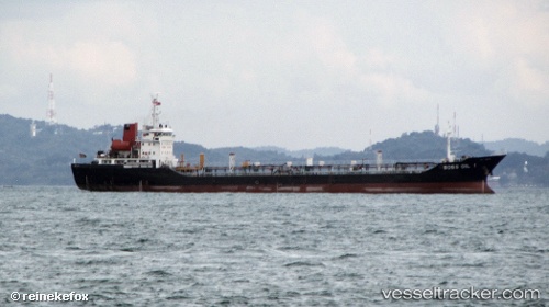
 AVA
AVA
Current Status
Where is the vessel?
AVA is currently in Near Pulau Indah, based on AIS data received about 14h ago.
Latest AIS update:
Current position: 2.79446° N, 101.30389° E (Near Pulau Indah)
Average speed (last 7 days): Loading…
Average speed (last 30 days): Loading…
Vessel profile: AVA is a Oil Products Tanker with dimensions m x m.
This page combines live AIS, route history, probable destination signals, nearby traffic, and port activity for practical vessel monitoring.
The current position of vessel AVA is 2.79446 lat / 101.30389 lng. Updated: 2026-05-18 00:06:41 UTCNearest reference points:
- Near Pulau Indah
- Near Carey Island Estate
- Near Banting
Currently sailing under the flag of Sierra Leone ![]()
Details:
Live Vessel AVA Analytics (details, animations, etc.)
Recent AIS points (UTC):
2026-05-17 19:42:43 UTC · 2.79582, 101.30195 · SOG 0 kn · COG 97°2026-05-17 22:00:40 UTC · 2.79444, 101.30369 · SOG 0 kn · COG 331°
2026-05-17 22:12:43 UTC · 2.79444, 101.30375 · SOG 0 kn · COG 327°
2026-05-18 00:06:41 UTC · 2.79446, 101.30389 · SOG 0 kn · COG 313°