 Nord Taipei
Current Status
Where is the vessel?
Nord Taipei is currently in Near Hobart, based on AIS data received about 14h ago.
Latest AIS update:
Current position: 42.93257° S, 147.38979° E (Near Hobart)
Average speed (last 7 days): Loading…
Average speed (last 30 days): Loading…
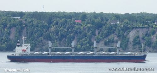
Vessel profile: Nord Taipei is a General Cargo Ship with dimensions 177m x 28m.
This page combines live AIS, route history, probable destination signals, nearby traffic, and port activity for practical vessel monitoring.
The current position of vessel Nord Taipei is -42.93257 lat / 147.38979 lng. Updated: 2026-05-20 09:43:27 UTCNearest reference points:
- Near Hobart
- Near LINDISFARNE
- Near BLUNY ISLAND
Currently sailing under the flag of Panama ![]()
Nord Taipei built in 2011 year
Deadweight:
33143 tDetails:
Live Vessel Nord Taipei Analytics (details, animations, etc.)
Recent AIS points (UTC):
2026-05-20 06:28:24 UTC · -42.93350, 147.39182 · SOG 0 kn · COG 247°2026-05-20 07:31:31 UTC · -42.93267, 147.39087 · SOG 0 kn · COG 211°
2026-05-20 07:37:27 UTC · -42.93271, 147.39082 · SOG 0 kn · COG 211°
2026-05-20 09:43:27 UTC · -42.93257, 147.38979 · SOG 0 kn · COG 186°