 Gulf Barakah
Current Status
Where is the vessel?
Gulf Barakah is currently in Near Mombasa, based on AIS data received about 14h ago.
Latest AIS update:
Current position: 4.06966° S, 39.65181° E (Near Mombasa)
Average speed (last 7 days): Loading…
Average speed (last 30 days): Loading…
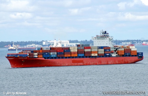
Vessel profile: Gulf Barakah is a Container Ship with dimensions 32m x 262m.
This page combines live AIS, route history, probable destination signals, nearby traffic, and port activity for practical vessel monitoring.
The current position of vessel Gulf Barakah is -4.06966 lat / 39.65181 lng. Updated: 2026-05-18 21:35:07 UTCNearest reference points:
- Near Mombasa
- 11 nm SE of Mombasa
Currently sailing under the flag of Marshall Is ![]()
Gulf Barakah built in 0 year
Deadweight:
0 tDetails:
Live Vessel Gulf Barakah Analytics (details, animations, etc.)
Recent AIS points (UTC):
2026-05-18 18:25:19 UTC · -4.08728, 39.76357 · SOG 1.8 kn · COG 148°2026-05-18 19:28:28 UTC · -4.09949, 39.73914 · SOG 2.7 kn · COG 124°
2026-05-18 20:03:36 UTC · -4.07467, 39.74430 · SOG 2.4 kn · COG 65°
2026-05-18 21:35:07 UTC · -4.06966, 39.65181 · SOG 10.5 kn · COG 310°