 vesseltracker.com
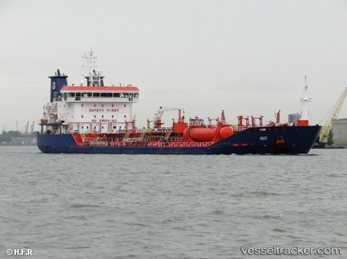
 OVIT
OVIT
Current Status
Where is the vessel?
OVIT is currently in Near Dunstaffnage, based on AIS data received about 15h ago.
Latest AIS update:
Current position: 57.34600° N, 6.86770° W (Near Dunstaffnage)
Average speed (last 7 days): Loading…
Average speed (last 30 days): Loading…
Vessel profile: OVIT is a Oil/Chemical Tanker with dimensions m x m.
This page combines live AIS, route history, probable destination signals, nearby traffic, and port activity for practical vessel monitoring.
The current position of vessel OVIT is 57.34600 lat / -6.86770 lng. Updated: 2026-05-18 10:09:07 UTCNearest reference points:
- Near North Harris
- Near KYLE OF LOCHALSH
- Near Fishnish, Isle of Mull
Currently sailing under the flag of Malta ![]()
Details:
Live Vessel OVIT Analytics (details, animations, etc.)
Recent AIS points (UTC):
2026-05-18 07:24:27 UTC · 56.92459, -6.94571 · SOG 9.4 kn · COG 35°2026-05-18 08:20:06 UTC · 57.06708, -6.90280 · SOG 9.3 kn · COG 0°
2026-05-18 09:42:17 UTC · 57.27709, -6.88303 · SOG 9.3 kn · COG 4°
2026-05-18 10:09:07 UTC · 57.34600, -6.86770 · SOG 9.3 kn · COG 2°