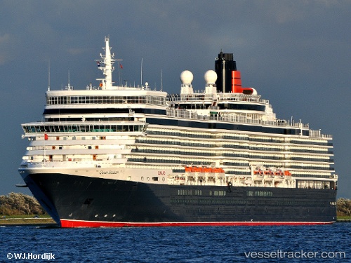
 Queen Elizabeth
Current Status
Where is the vessel?
Queen Elizabeth is currently in 37 nm S of Nootka, based on AIS data received about 14h ago.
Latest AIS update:
Current position: 48.98577° N, 126.52506° W (37 nm S of Nootka)
Average speed (last 7 days): Loading…
Average speed (last 30 days): Loading…
Vessel profile: Queen Elizabeth is a Cruise Ship with dimensions 294m x 36m.
This page combines live AIS, route history, probable destination signals, nearby traffic, and port activity for practical vessel monitoring.
The current position of vessel Queen Elizabeth is 48.98577 lat / -126.52506 lng. Updated: 2026-05-20 06:34:58 UTCNearest reference points:
- 21 nm NW of Tatoosh Island
- Near PORT HARDY
- Near Powell River
Currently sailing under the flag of Bermuda ![]()
Queen Elizabeth built in 2010 year
Deadweight:
7685 tDetails:
Live Vessel Queen Elizabeth Analytics (details, animations, etc.)
Recent AIS points (UTC):
2026-05-20 01:34:29 UTC · 50.01044, -128.53868 · SOG 20.2 kn · COG 130°2026-05-20 04:14:15 UTC · 49.45955, -127.47479 · SOG 19.7 kn · COG 125°
2026-05-20 04:20:09 UTC · 49.43991, -127.43613 · SOG 19.7 kn · COG 126°
2026-05-20 06:34:58 UTC · 48.98577, -126.52506 · SOG 20.1 kn · COG 128°