 vesseltracker.com
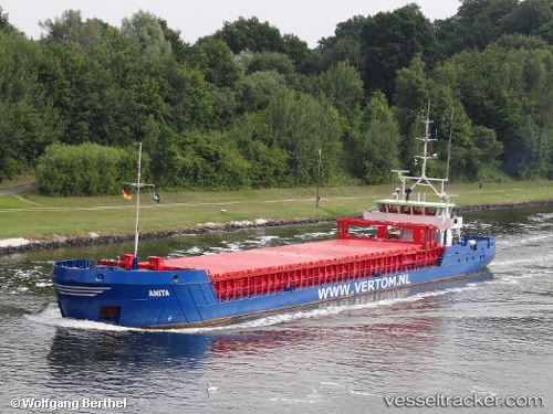
 Anita
Anita
Current Status
Where is the vessel?
Anita is currently in 49 nm S of Bredevoort, based on AIS data received about 14h ago.
Latest AIS update:
Current position: 51.15500° N, 6.38500° W (49 nm S of Bredevoort)
Average speed (last 7 days): Loading…
Average speed (last 30 days): Loading…
Vessel profile: Anita is a Multi Purpose Carrier with dimensions 88m x 11m.
This page combines live AIS, route history, probable destination signals, nearby traffic, and port activity for practical vessel monitoring.
The current position of vessel Anita is 51.15500 lat / -6.38500 lng. Updated: 2026-05-18 09:36:30 UTCNearest reference points:
- 45 nm SE of Covent Garden
- 10 nm NW of Grampound
- Near WEXFORD
Currently sailing under the flag of Netherlands ![]()
Anita built in 2013 year
Deadweight:
2625 tDetails:
Live Vessel Anita Analytics (details, animations, etc.)
Recent AIS points (UTC):
2026-05-18 05:48:04 UTC · 50.68766, -6.01628 · SOG 8.4 kn · COG 327°2026-05-18 07:18:27 UTC · 50.87333, -6.20500 · SOG 8 kn · COG -1°
2026-05-18 08:12:29 UTC · 50.97667, -6.33500 · SOG 8 kn · COG -1°
2026-05-18 09:36:30 UTC · 51.15500, -6.38500 · SOG 9 kn · COG -1°