 SAFEEN AL AMAL
Current Status
Where is the vessel?
SAFEEN AL AMAL is currently in 96 nm NE of Gross Koris, based on AIS data received about 14h ago.
Latest AIS update:
Current position: 14.31680° N, 53.67979° E (96 nm NE of Gross Koris)
Average speed (last 7 days): Loading…
Average speed (last 30 days): Loading…
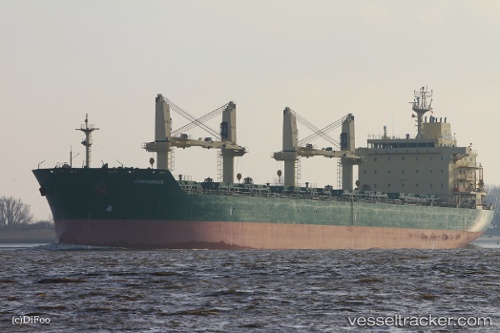
Vessel profile: SAFEEN AL AMAL is a Bulk Carrier with dimensions 180m x 30m.
This page combines live AIS, route history, probable destination signals, nearby traffic, and port activity for practical vessel monitoring.
The current position of vessel SAFEEN AL AMAL is 14.31680 lat / 53.67979 lng. Updated: 2026-06-04 02:00:44 UTCNearest reference points:
- 110 nm NE of Gross Koris
- 106 nm S of Port Raysut
- 103 nm S of Port Raysut
Currently sailing under the flag of Marshall Islands ![]()
SAFEEN AL AMAL built in 2011 year
Deadweight:
34420 tDetails:
Live Vessel SAFEEN AL AMAL Analytics (details, animations, etc.)
Recent AIS points (UTC):
2026-06-03 22:34:17 UTC · 14.30229, 52.86671 · SOG 13.8 kn · COG 75°2026-06-03 23:40:33 UTC · 14.34373, 53.12122 · SOG 13.6 kn · COG 95°
2026-06-04 01:35:44 UTC · 14.32094, 53.58010 · SOG 14.2 kn · COG 92°
2026-06-04 02:00:44 UTC · 14.31680, 53.67979 · SOG 13.9 kn · COG 94°