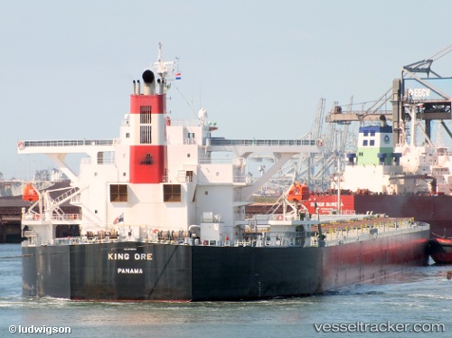
.
Vessel photo of CAPE SARINA (IMO 9490612) vesseltracker.com

MH flag CAPE SARINA

Vessel type: Bulk Carrier | IMO: 9490612 | MMSI: MMSI: 538009315
Call sign: V7A4581 | Dimensions: 45 m x 289 m
Current Status

Where is the vessel?

CAPE SARINA is currently in 19 nm S of Selat Lombok, based on AIS data received about 14h ago.

Latest AIS update:

Current position: 9.14244° S, 115.68897° E (19 nm S of Selat Lombok)

Average speed (last 7 days): Loading…

Average speed (last 30 days): Loading…

Vessel profile: CAPE SARINA is a Bulk Carrier with dimensions 45m x 289m.

This page combines live AIS, route history, probable destination signals, nearby traffic, and port activity for practical vessel monitoring.

The current position of vessel CAPE SARINA is -9.14244 lat / 115.68897 lng. Updated: 2026-05-18 01:37:19 UTC
More recent position available: 1 h 28 min ago

Shipinfo shows free vessel positions with a delay. After payment, you will be able to view the current position of this vessel for 24 hours.

We recommend registering. If you register, paid vessel access will be saved in your profile. Guest access works only through a personal link.

Nearest reference points:
  • Near LEMBAR
  • Near BENOA
  • 29 nm N of MANGGIS

Currently sailing under the flag of Marshall Islands MH flag

CAPE SARINA built in 2010 year

Deadweight:
176818 t

Details:

Live Vessel CAPE SARINA Analytics (details, animations, etc.)


Recent AIS points (UTC):
2026-05-17 22:04:29 UTC · -8.31801, 115.83486 · SOG 12.4 kn · COG 202°
2026-05-17 22:15:29 UTC · -8.35447, 115.81979 · SOG 13 kn · COG 199°
2026-05-18 00:07:21 UTC · -8.78408, 115.67464 · SOG 15.3 kn · COG 192°
2026-05-18 01:37:19 UTC · -9.14244, 115.68897 · SOG 13.7 kn · COG 171°

UTC: --
Start: -- Track timeline (UTC) End: --
Encountered: --


Link to the map:


Find another ship

CAPE_SARINA (538009315) last ports (portcalls and passsages)

Qingdao | 2025-07-17 07:20:43
PENGERANG | 2025-07-05 18:55:07
TANAH MERAH | 2025-07-05 16:59:24
PULAU SAMBU | 2025-07-05 15:56:45
BUKOM ISLAND | 2025-07-05 14:56:00
Port Elizabeth | 2025-05-06 09:57:25
Krishnapatnam | 2025-04-19 00:26:09
Krishnapatnam | 2025-04-15 00:13:13
GANGAVARAM | 2025-04-09 22:19:45
VISAKHAPATNAM | 2025-04-08 02:02:56
GANGAVARAM | 2025-04-05 21:27:31
JURONG ISLAND | 2025-03-31 03:54:55
TANAH MERAH | 2025-03-29 20:39:59
PENGERANG | 2025-03-29 19:42:22
Muara Pantai | 2025-03-17 01:11:45
Muara Pantai | 2025-03-12 23:58:07
Muara Pantai | 2025-03-08 23:22:52
JINGTANG | 2025-02-22 22:22:00
Dampier | 2025-02-05 11:23:16
Selat Lombok | 2025-01-20 05:01:21
Subic Bay | 2025-01-15 07:14:57
TANAH MERAH | 2024-12-22 09:22:18
Singapore | 2024-12-22 07:21:55
PULAU SAMBU | 2024-12-22 06:49:10
Cape Of Good Hope | 2024-11-29 08:03:12
Qingdao | 2024-08-25 18:36:19
Sambu | 2024-08-13 05:55:58
Port Elizabeth | 2024-06-19 17:24:45
Port Louis | 2024-06-12 08:38:00
Vishakhapatnam | 2024-05-30 10:30:18
Vishakhapatnam | 2024-05-26 09:17:49
Port Elizabeth | 2024-05-06 08:34:13
Cape Of Good Hope | 2024-03-10 13:20:55
Singapore | 2024-02-11 09:22:41
Bayuquan | 2024-01-14 20:19:00
Port Elizabeth | 2023-10-25 09:35:58
Singapore | 2023-08-15 05:43:00
Sambu | 2023-08-15 05:28:44
Port Elizabeth | 2023-05-30 13:00:27
Singapore | 2023-05-12 03:34:46
Singapore | 2023-04-13 12:00:27
Richards Bay | 2023-03-26 10:29:11
Richards Bay | 2023-03-22 02:04:43
Richards Bay | 2023-03-18 00:02:39
Richards Bay | 2023-03-13 23:23:51
Richards Bay | 2023-03-09 14:08:45
Maputo | 2023-03-04 08:59:47
Maputo | 2023-02-28 08:28:03
Zamboanga | 2023-01-22 17:40:16