 SAN GEORGE
Current Status
Where is the vessel?
SAN GEORGE is currently in 136 nm E of Inhambane, based on AIS data received about 15h ago.
Latest AIS update:
Current position: 23.01985° S, 37.66069° E (136 nm E of Inhambane)
Average speed (last 7 days): Loading…
Average speed (last 30 days): Loading…
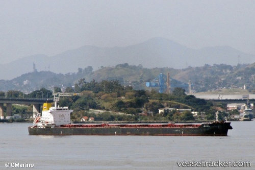
Vessel profile: SAN GEORGE is a Bulk Carrier with dimensions m x m.
This page combines live AIS, route history, probable destination signals, nearby traffic, and port activity for practical vessel monitoring.
The current position of vessel SAN GEORGE is -23.01985 lat / 37.66069 lng. Updated: 2026-05-19 01:36:08 UTCCurrently sailing under the flag of Portugal ![]()
Details:
Live Vessel SAN GEORGE Analytics (details, animations, etc.)
Recent AIS points (UTC):
2026-05-18 22:54:00 UTC · -22.65639, 37.98780 · SOG 10.4 kn · COG 213°2026-05-18 23:36:30 UTC · -22.75223, 37.90113 · SOG 10.8 kn · COG 213°
2026-05-19 01:29:39 UTC · -23.00521, 37.67321 · SOG 10.4 kn · COG 216°
2026-05-19 01:36:08 UTC · -23.01985, 37.66069 · SOG 10.2 kn · COG 215°