Seroja Tiga
Current StatusWhere is the vessel?
Seroja Tiga is currently in Near Mount Nathan, based on AIS data received about 14h ago.
Latest AIS update:
Current position: 27.04962° S, 153.28455° E (Near Mount Nathan)
Average speed (last 7 days): Loading…
Average speed (last 30 days): Loading…
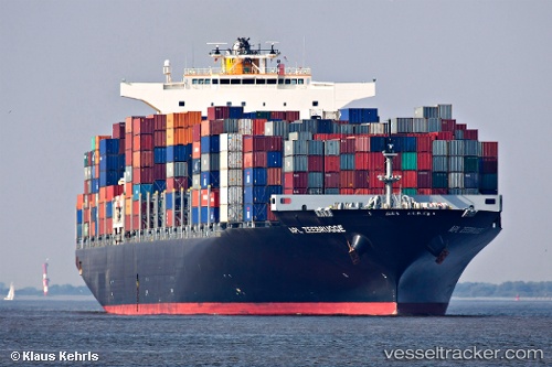
Vessel profile: Seroja Tiga is a Container Ship with dimensions 46m x 316m.
This page combines live AIS, route history, probable destination signals, nearby traffic, and port activity for practical vessel monitoring.
The current position of vessel Seroja Tiga is -27.04962 lat / 153.28455 lng. Updated: 2026-05-20 00:13:52 UTCNearest reference points:
- Near Bulwer
- Near Minyama
- Near MOOLOOLABA
Details:
Live Vessel Seroja Tiga Analytics (details, animations, etc.)
Recent AIS points (UTC):
2026-05-19 19:43:12 UTC · -27.37419, 153.16908 · SOG 0 kn · COG 31°2026-05-19 22:17:09 UTC · -27.37327, 153.16805 · SOG 0.7 kn · COG 37°
2026-05-19 22:26:59 UTC · -27.36790, 153.17079 · SOG 5 kn · COG 23°
2026-05-20 00:13:52 UTC · -27.04962, 153.28455 · SOG 14.5 kn · COG 289°