 vesseltracker.com
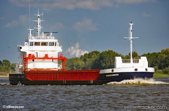
 MIA MARIA
Current Status
Where is the vessel?
MIA MARIA is currently in Near Prestwick, based on AIS data received about 14h ago.
Latest AIS update:
Current position: 55.47087° N, 4.63863° W (Near Prestwick)
Average speed (last 7 days): Loading…
Average speed (last 30 days): Loading…
Vessel profile: MIA MARIA is a General Cargo with dimensions m x m.
This page combines live AIS, route history, probable destination signals, nearby traffic, and port activity for practical vessel monitoring.
The current position of vessel MIA MARIA is 55.47087 lat / -4.63863 lng. Updated: 2026-05-18 14:03:34 UTCNearest reference points:
- Near Ardrossan
- Near Lamlash
- Near Cumbraes
Details:
Live Vessel MIA MARIA Analytics (details, animations, etc.)
Recent AIS points (UTC):
2026-05-18 10:09:09 UTC · 55.47086, -4.63856 · SOG 0 kn · COG 50°2026-05-18 11:20:42 UTC · 55.47088, -4.63864 · SOG 0.1 kn · COG 46°
2026-05-18 13:50:42 UTC · 55.47086, -4.63863 · SOG 0 kn · COG 48°
2026-05-18 14:03:34 UTC · 55.47087, -4.63863 · SOG 0 kn · COG 47°