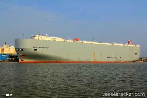
 Bosporus Highway
Current Status
Where is the vessel?
Bosporus Highway is currently in 33 nm SW of Baía dos Tigres, based on AIS data received about 14h ago.
Latest AIS update:
Current position: 16.97081° S, 11.30920° E (33 nm SW of Baía dos Tigres)
Average speed (last 7 days): Loading…
Average speed (last 30 days): Loading…
Vessel profile: Bosporus Highway is a Vehicles Carrier with dimensions 199m x 199m.
This page combines live AIS, route history, probable destination signals, nearby traffic, and port activity for practical vessel monitoring.
The current position of vessel Bosporus Highway is -16.97081 lat / 11.30920 lng. Updated: 2026-05-19 04:12:23 UTCNearest reference points:
- 136 nm S of Baía dos Tigres
Currently sailing under the flag of Panama ![]()
Bosporus Highway built in 2009 year
Deadweight:
18792 tDetails:
Live Vessel Bosporus Highway Analytics (details, animations, etc.)
Recent AIS points (UTC):
2026-05-19 01:19:05 UTC · -17.76019, 11.36829 · SOG 16.7 kn · COG 359°2026-05-19 01:48:00 UTC · -17.62645, 11.36621 · SOG 16.6 kn · COG 359°
2026-05-19 03:58:13 UTC · -17.03339, 11.32160 · SOG 16.2 kn · COG 346°
2026-05-19 04:12:23 UTC · -16.97081, 11.30920 · SOG 16 kn · COG 358°