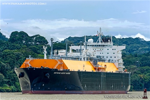
 METHANE MICKIE HARPER
Current Status
Where is the vessel?
METHANE MICKIE HARPER is currently in 27 nm W of Watson Island, based on AIS data received about 15h ago.
Latest AIS update:
Current position: 54.06890° N, 131.01164° W (27 nm W of Watson Island)
Average speed (last 7 days): Loading…
Average speed (last 30 days): Loading…
Vessel profile: METHANE MICKIE HARPER is a LNG Tanker with dimensions 45m x 290m.
This page combines live AIS, route history, probable destination signals, nearby traffic, and port activity for practical vessel monitoring.
The current position of vessel METHANE MICKIE HARPER is 54.06890 lat / -131.01164 lng. Updated: 2026-05-19 14:08:17 UTCNearest reference points:
- Near Prince Rupert
- Near Watson Island
- 15 nm N of Port Clements
Currently sailing under the flag of Panama ![]()
METHANE MICKIE HARPER built in 2010 year
Deadweight:
86170 tDetails:
Live Vessel METHANE MICKIE HARPER Analytics (details, animations, etc.)
Recent AIS points (UTC):
2026-05-19 11:00:50 UTC · 53.62803, -130.38942 · SOG 9.5 kn · COG 307°2026-05-19 11:33:20 UTC · 53.68537, -130.50887 · SOG 11.1 kn · COG 312°
2026-05-19 13:18:17 UTC · 53.90622, -130.94395 · SOG 11.3 kn · COG 321°
2026-05-19 14:08:17 UTC · 54.06890, -131.01164 · SOG 12.6 kn · COG 356°