 DHT REDWOOD
Current Status
Where is the vessel?
DHT REDWOOD is currently in 121 nm S of Keti Bandar, based on AIS data received about 14h ago.
Latest AIS update:
Current position: 22.18124° N, 66.87695° E (121 nm S of Keti Bandar)
Average speed (last 7 days): Loading…
Average speed (last 30 days): Loading…
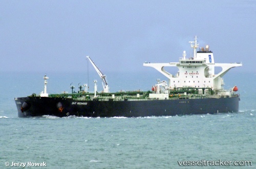
Vessel profile: DHT REDWOOD is a Crude Oil Tanker with dimensions m x m.
This page combines live AIS, route history, probable destination signals, nearby traffic, and port activity for practical vessel monitoring.
The current position of vessel DHT REDWOOD is 22.18124 lat / 66.87695 lng. Updated: 2026-05-18 22:05:51 UTCNearest reference points:
- 84 nm SW of Keti Bandar
- 49 nm S of Positra
- 231 nm SW of Keti Bandar
Currently sailing under the flag of Marshall Islands ![]()
Details:
Live Vessel DHT REDWOOD Analytics (details, animations, etc.)
Recent AIS points (UTC):
2026-05-18 19:41:01 UTC · 22.05285, 67.36086 · SOG 4.2 kn · COG 248°2026-05-18 20:14:01 UTC · 22.07202, 67.28005 · SOG 11.2 kn · COG 284°
2026-05-18 21:50:42 UTC · 22.16676, 66.93225 · SOG 12.8 kn · COG 285°
2026-05-18 22:05:51 UTC · 22.18124, 66.87695 · SOG 12.6 kn · COG 285°