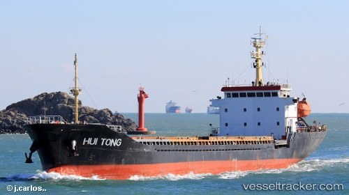
 Hui Tong
Current Status
Where is the vessel?
Hui Tong is currently in Near Dalzavod, based on AIS data received about 14h ago.
Latest AIS update:
Current position: 43.10439° N, 131.92093° E (Near Dalzavod)
Average speed (last 7 days): Loading…
Average speed (last 30 days): Loading…
Vessel profile: Hui Tong is a General Cargo Ship with dimensions 100m x 16m.
This page combines live AIS, route history, probable destination signals, nearby traffic, and port activity for practical vessel monitoring.
The current position of vessel Hui Tong is 43.10439 lat / 131.92093 lng. Updated: 2026-05-30 13:28:55 UTCNearest reference points:
- Near Dalzavod
- Near Vostokmorservice
- Near Vladivostok
Currently sailing under the flag of Panama ![]()
Details:
Live Vessel Hui Tong Analytics (details, animations, etc.)
Recent AIS points (UTC):
2026-05-28 22:35:11 UTC · 43.11303, 131.91328 · SOG 1.7 kn · COG -1°2026-05-28 22:35:11 UTC · 43.11303, 131.91328 · SOG 1.7 kn · COG -1°
2026-05-30 13:28:55 UTC · 43.10439, 131.92093 · SOG 0 kn · COG -1°
2026-05-30 13:28:55 UTC · 43.10439, 131.92093 · SOG 0 kn · COG -1°