 Miramar
Current Status
Where is the vessel?
Miramar is currently in 17 nm N of Visby, based on AIS data received about 15h ago.
Latest AIS update:
Current position: 57.90736° N, 18.16844° E (17 nm N of Visby)
Average speed (last 7 days): Loading…
Average speed (last 30 days): Loading…
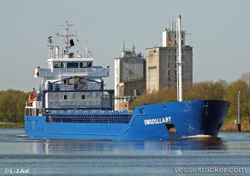
Vessel profile: Miramar is a Multi Purpose Carrier with dimensions 99m x 13m.
This page combines live AIS, route history, probable destination signals, nearby traffic, and port activity for practical vessel monitoring.
The current position of vessel Miramar is 57.90736 lat / 18.16844 lng. Updated: 2026-05-20 10:25:52 UTCNearest reference points:
- Near Stora Vika
- Near SODERTALJE
- Near Gustavsvik/Stockholm
Currently sailing under the flag of Cyprus ![]()
Miramar built in 2011 year
Deadweight:
5233 tDetails:
Live Vessel Miramar Analytics (details, animations, etc.)
Recent AIS points (UTC):
2026-05-20 07:44:21 UTC · 58.34542, 18.61927 · SOG 11.5 kn · COG 211°2026-05-20 08:06:21 UTC · 58.28620, 18.54934 · SOG 11.3 kn · COG 210°
2026-05-20 09:41:31 UTC · 58.03220, 18.26046 · SOG 11.1 kn · COG 212°
2026-05-20 10:25:52 UTC · 57.90736, 18.16844 · SOG 11.1 kn · COG 211°