 vesseltracker.com
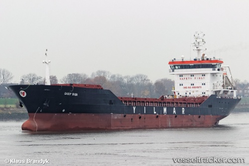
 Garip Baba
Current Status
Where is the vessel?
Garip Baba is currently in Near Isdemir, based on AIS data received about 1h ago.
Latest AIS update:
Current position: 36.78171° N, 36.19436° E (Near Isdemir)
Average speed (last 7 days): Loading…
Average speed (last 30 days): Loading…
Vessel profile: Garip Baba is a General Cargo Ship with dimensions 122m x 16m.
This page combines live AIS, route history, probable destination signals, nearby traffic, and port activity for practical vessel monitoring.
The current position of vessel Garip Baba is 36.78171 lat / 36.19436 lng. Updated: 2026-05-17 01:42:29 UTCNearest reference points:
- Near DORTYOL
- Near Iskenderun
- Near CEYHAN
Currently sailing under the flag of Turkey ![]()
Garip Baba built in 2010 year
Deadweight:
8500 tDetails:
Live Vessel Garip Baba Analytics (details, animations, etc.)
Recent AIS points (UTC):
2026-05-16 22:39:30 UTC · 36.78170, 36.19439 · SOG 0 kn · COG 258°2026-05-16 23:18:29 UTC · 36.78171, 36.19439 · SOG 0 kn · COG 258°
2026-05-17 01:27:28 UTC · 36.78172, 36.19435 · SOG 0.1 kn · COG 257°
2026-05-17 01:42:29 UTC · 36.78171, 36.19436 · SOG 0.1 kn · COG 258°