 vesseltracker.com
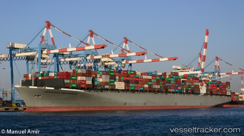
 ONE HANGZHOU BAY
Current Status
Where is the vessel?
ONE HANGZHOU BAY is currently in 291 nm SW of Harper, based on AIS data received about 14h ago.
Latest AIS update:
Current position: 0.32015° N, 10.40176° W (291 nm SW of Harper)
Average speed (last 7 days): Loading…
Average speed (last 30 days): Loading…
Vessel profile: ONE HANGZHOU BAY is a Container Ship with dimensions m x m.
This page combines live AIS, route history, probable destination signals, nearby traffic, and port activity for practical vessel monitoring.
The current position of vessel ONE HANGZHOU BAY is 0.32015 lat / -10.40176 lng. Updated: 2026-05-17 19:48:12 UTCNearest reference points:
- Open sea, approx. 402 nm off the nearest listed port
- Open sea, approx. 403 nm off the nearest listed port
- Open sea, approx. 404 nm off the nearest listed port
Currently sailing under the flag of Japan ![]()
Details:
Live Vessel ONE HANGZHOU BAY Analytics (details, animations, etc.)
Recent AIS points (UTC):
2026-05-17 16:21:24 UTC · -0.25067, -9.86428 · SOG 13.3 kn · COG 317°2026-05-17 17:40:43 UTC · -0.03530, -10.06777 · SOG 13.5 kn · COG 317°
2026-05-17 19:38:21 UTC · 0.29214, -10.37673 · SOG 13.7 kn · COG 319°
2026-05-17 19:48:12 UTC · 0.32015, -10.40176 · SOG 13.8 kn · COG 319°