 STELIOS T
Current Status
Where is the vessel?
STELIOS T is currently in 145 nm S of Fernando De Noronha, based on AIS data received about 14h ago.
Latest AIS update:
Current position: 6.16106° S, 31.75895° W (145 nm S of Fernando De Noronha)
Average speed (last 7 days): Loading…
Average speed (last 30 days): Loading…
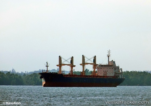
Vessel profile: STELIOS T is a Bulk Carrier with dimensions m x m.
This page combines live AIS, route history, probable destination signals, nearby traffic, and port activity for practical vessel monitoring.
The current position of vessel STELIOS T is -6.16106 lat / -31.75895 lng. Updated: 2026-05-20 23:54:03 UTCCurrently sailing under the flag of Marshall Islands ![]()
Details:
Live Vessel STELIOS T Analytics (details, animations, etc.)
Recent AIS points (UTC):
2026-05-20 19:18:33 UTC · -5.27339, -31.32428 · SOG 12.8 kn · COG 199°2026-05-20 21:49:43 UTC · -5.76117, -31.56020 · SOG 13 kn · COG 202°
2026-05-20 22:17:53 UTC · -5.85105, -31.60602 · SOG 12.8 kn · COG 202°
2026-05-20 23:54:03 UTC · -6.16106, -31.75895 · SOG 13.1 kn · COG 203°